Vermont’s 270-mile Long Trail winds its way down through the Green Mountains from Canada to Massachusetts. Check out these local hikes for some of the best views along the way.
Sunset Rock [LINCOLN]
This short hike—it’s 2.2 miles round-trip—starts at 2,410 feet from the top of Lincoln Gap Road and heads south on the Long Trail into the Breadloaf Wilderness area. The trail begins with moderately steep switchbacks through beech and maple trees, then rounds off among conifers before declining slightly to Sunset Rock, an overhang with commanding views west toward Lake Champlain. Remember to bring: A picnic, a warm layer, and a headlamp. Watch the sunset over the Adirondacks, and then descend under the moonlight.
Burnt Rock Mountain [FAYSTON]
Named for its bare summit, Burnt Rock Mountain is located in Camel’s Hump State Forest along the Long Trail, but can be accessed via a steep 5.2-mile round-trip hike from Big Basin Road in Fayston. The trail starts alongside Hedgehog Brook, climbing through hardwoods until it meets the Long Trail and the exposed rock of Burnt Rock Mountain. Turn right and follow the Long Trail’s white blazes to the summit, at 3,168 feet. Look north for a head-on view of the cliff bands of Camel’s Hump, west across Lake Champlain to the Adirondacks, or east across the Mad River Valley to the Worcester Mountains. Remember to bring: Your friends. The rock star Grace Potter sings about Burnt Rock in her song “Crazy Parade”: “I’m up on top of a big burnt rock, with some people I call friends. We’re half a mile to heaven. And back again.”
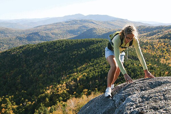
Gap to Gap [LINCOLN/FAYSTON]
The 11.6 miles along the Long Trail between Lincoln Gap Road and Route 17 (Appalachian Gap) stretch across two of Vermont’s 4,000-foot peaks. From Lincoln Gap the trail ascends north to Mount Abraham, passes by Sugarbush chairlifts on Lincoln and Castlerock Peaks, traverses above the fabled backcountry skiing in the Slide Brook Wilderness, summits Sugarbush’s Mt. Ellen, and then drops to Mad River Glen’s single chair on General Stark Mountain before ending at Route 17. Make it an overnighter at the Battell or Theron Dean Shelter or keep it a day trek. This difficult hike can be done in either direction, and requires a car drop or a ride. Remember to bring: Lots of water, sun block, and a camera. The ridgeline hike offers expansive views and exposure to the elements.
Allyn’s Lodge [SUGARBUSH]
Named in memory of Allyn Schechter, a female skier who perished in a plane crash, the lodge on Sugarbush’s Gadd Peak is always open and provides respite to those in need of shelter. It’s also a great picnic spot for a family hike thanks to its proximity to the Super Bravo chairlift. The path to Allyn’s Lodge varies—ride the chairlift up and hike down, hike up mountain roads and ride the lift down, or hike both ways. At the top of the lift you’ll find the mid-mountain lodge with its large deck, a network of downhill mountain bike trails, and the option to continue up Lincoln Peak to the Long Trail. Remember to bring: Your discs and a map. Sugarbush’s Peak Disc Golf Course plays downhill from Allyn’s Lodge, and hiking trail and disc golf maps are available in the Gate House Lodge.
